Follow us


Orthophoto Processing

An orthophotograph is a mathematically and geographically rectified aerial color photograph that can be placed on a plan. The process of creating an orthophotograph entails correcting exposure distortions induced by ground surface relief. Digital orthophotos are used as maps, as well as a combination of other mapping products such as DTM and contours, for visual identification.

We specialize in working with (certified & established) Image Processing algorithms – (PIX4d in our case )  to create a digital Orthophoto that most closely matches the resolution and the continual tone of the original aerial image. Color and contrast matching, as well as feathering techniques, are used to create an almost seamless mosaic. To supplement the original orthoimages, many images can be mosaicked and resampled to provide an overview image file. Reliability is measured simply by comparing the fixed position of the said ground control point to the true coordinate of the points.

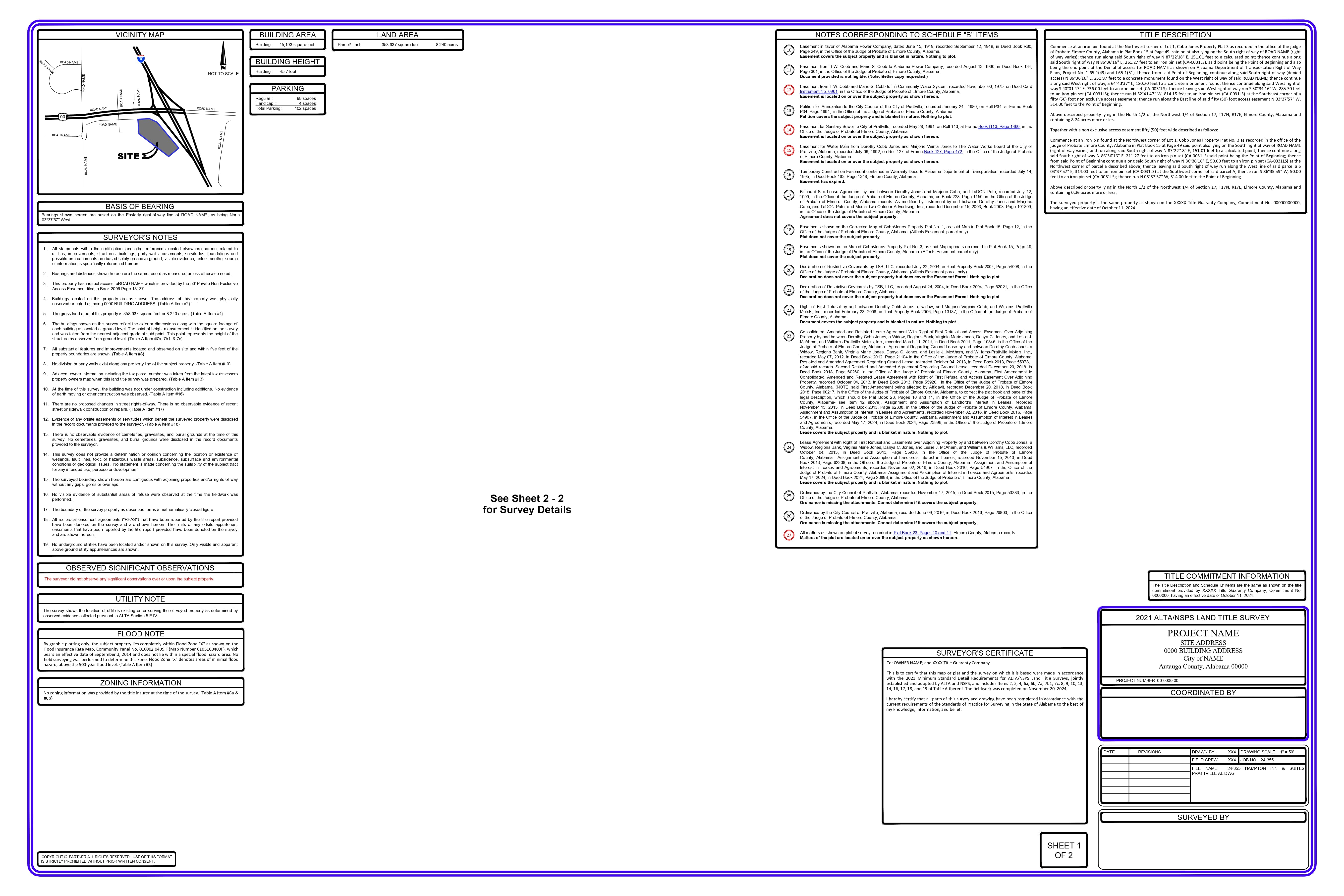
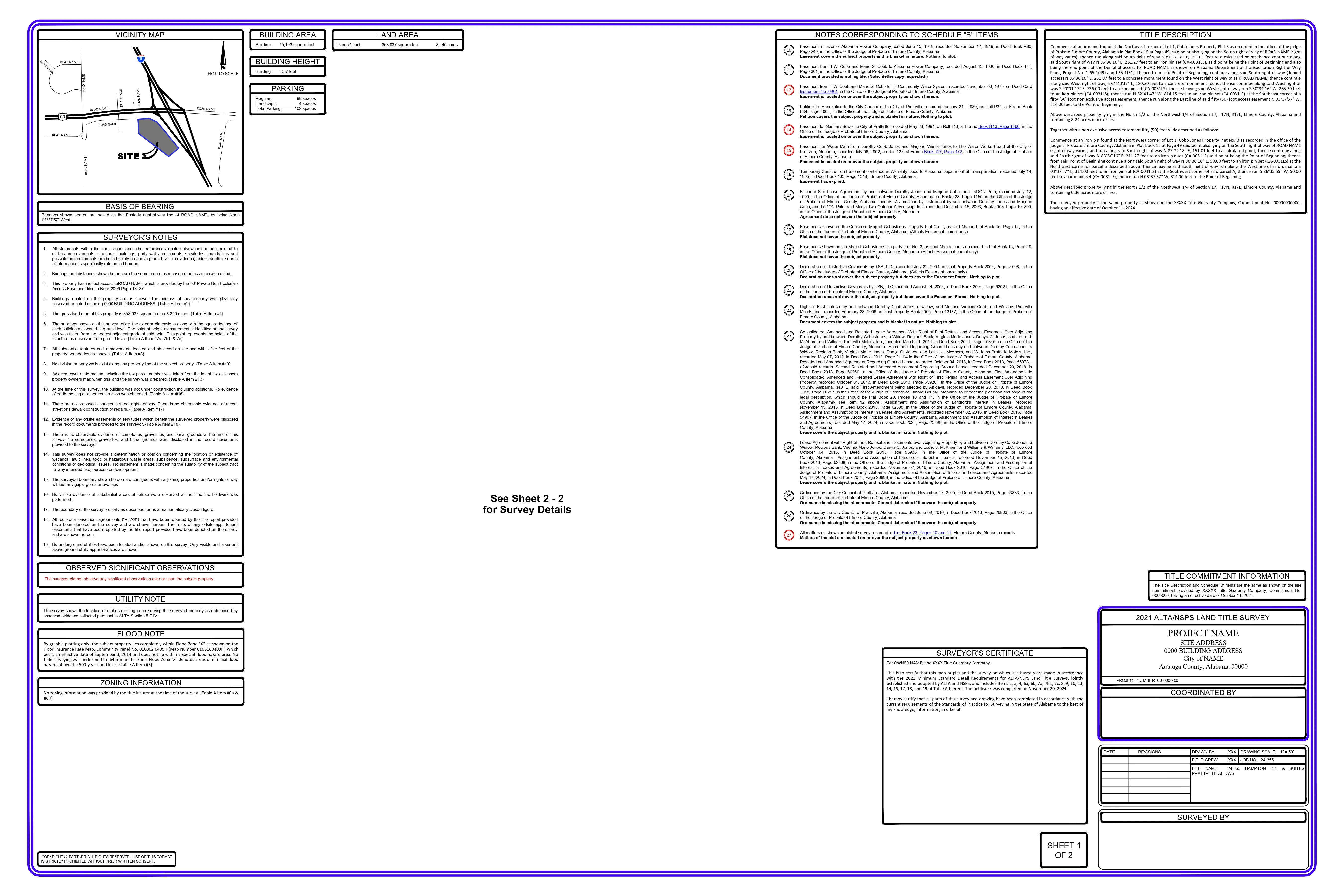
At TheDraftRack., we generate Orthophoto with pixel sizes of 10cm, 20cm, 40 cm.  We also specialize in working with RGB & Infrared datasets as well as imagery. We follow strict standards for achieving survey grade accuracy by following ASPRS and NSPS standards

Our process is based on the PIX4D work flow: 

  • Feature Identification
  • Feature Matching
  • Geolocation GPS/GCP – Model location based on geolocation
  • Reflection & Index Map
  • DSM/DTM  – Computation of volume
  • Orthomosaic – Focuses on removing distortions
  • Final CAD & drawings with contours 

Software Expertise

  • Pix4D

Our Strengths

  • Accurate & consistent:  our philosophy is “we may do less, but never compromise on quality and consistency” 
  • Quick turnaround: (Leveraging our time zone advantage, we can have a team working while you’re sleeping as well as while you’re at work. You can have all the work turned in well before your day begins i.e., before 9:00 AM ET) 
  • Familiarity with the American parcel Systems: (Metes & Bounds, Public Land Survey Systems: Sectional Infractions, Lot & Blocks et al.) 
  • Technical & Domain wherewithal: across various software and states within the US 
  • Cost-Effective: Cost-benefit dovetailed with Quality is the bedrock of the very DNA of our business  
  • Excellent with communication – something we believe is key to any good relationship Scalability without ever losing sight of accuracy and consistency. 
  • Mitigate Risk - Help you create a distributed strategy that enables you to mitigate risk